Map-making impacts our perception of the world
This lesson was created as the culminating project in the Association for Media Literacy’s Spring 2022 Additional Qualifications Course.
The AML is grateful to C. Lim for her creativity and permission to share this lesson. Please credit C. Lim when you share the lesson.
A special quality of this lesson is that it is scalable: although it was designed for Secondary high school students, it can be easily adapted for Elementary (Primary or Middle School) students.
by C. Lim OCT Toronto District School Board
This unit could also serve as a cross-curricular activity for English (see note below)
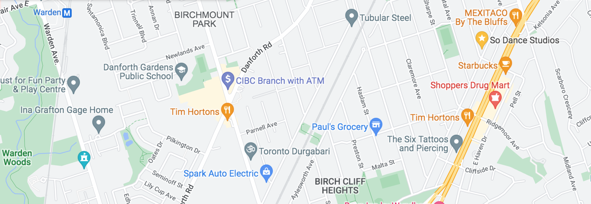
Google Maps
Lesson Plan and Timing/Duration
This will be an introductory lesson to maps and map-making before teaching specific map elements/concepts and skills (i.e., using GIS and Google Maps).
The lesson will take two 75 minute periods.
Learning Goals and Key Concepts
To recognize how maps are used to represent our sense of place
To interpret the spatial relationships between physical and human features
To recognize that maps are representations and constructions of reality and subject to biases (Key Concept 2 – Media construct versions of reality)
Since maps are created by people, there is creator bias (choice of information to include/exclude and how to represent that information)
Even if technology is used to produce the map, there is bias from the medium (e.g., maps are 2-dimensional, impossible to include every aspect of reality on a map)
To recognize that maps are a form of media and have unique aesthetic forms (Key Concept 6 – Each medium has a unique aesthetic form)
Maps are recognized as tools to represent spatial information and include specific conventions (scale, grid lines, legend)
To recognize that maps can communicate values, political and social messages (Key Concept 3 – Audiences negotiate meaning):
Meaning is constructed in the minds of the audience – responses (meaning) to information presented in the completed map will be different for individual audience members
Media Literacy Expectations
1. Understanding Media Texts: explain how media texts are created to suit particular purposes and audiences
2. Understanding Media Forms, Conventions, and Techniques: Identify some media forms and explain how the conventions and techniques associated with them are used to create meaning
3. Creating Media Texts: create a variety of media texts for different purposes and audiences, using appropriate forms, conventions and techniques
4. Reflecting on Skills and Strategies: reflect on and identify their strengths as media interpreters and creators, areas of improvement and the strategies they found most helpful in understanding and creating media texts.
Geography Expectations
Overall and Specific Expectations:
A1 Geographic Inquiry and Skill Development:
—1.3 assess the credibility of sources and information relevant to their investigations
—1.7 Communicate their ideas, arguments, and conclusions using various formats and styles
A2 Developing Transferable Skills:
—2.1 Describe ways in which geographic investigation can help them develop skills, including spatial technology skills and the essential skills in the Ontario Skills Passport
—2.2 Apply in everyday contexts skills and work habits developed through geographic investigation
Student Activities
Day 1: Opening activity – Mapping:
Students will draw a map of their neighbourhood
Class will debrief by reflecting on their maps, explaining how much detail they included and why they chose specific details
Students will learn about different forms and features of maps (about) and how they are used to show spatial information (through):
Teacher will introduce different types of maps: (topographic, thematic, political)
* Students will be shown different maps without titles to identify purpose (and why they think so) using Media Triangle and Key Concept ideas:
Who do you think produced this map? What was their purpose?
Who might find this map useful?
What conclusions can you make from the information?
What information is included and what is not included?
What features (i.e., symbols, colours, icons) are highlighted?
Day 2: Map-making
* Students will create their own maps with specific purposes and points-of-view in mind:
Students can choose what information they want to communicate through their maps (e.g., a school map showing the location of drinking fountains and washrooms; coffee shops/variety stores with the best snacks on the way to school; which streets are best lit at night, good dog-walking routes, good jogging routes, shortcuts, etc.
They will also consider how and where their maps will be distributed and/or who the audience would be
They will also submit a written reflection of the above considerations and their production process. They will use the Media Triangle questions to guide their responses.
Assessment Strategies
* Map products
* Reflection of learning in map-making process with specific reference to Media Literacy Key Concepts and/or Media Triangle
* Collaboration and communication
* Peer and self-assessments
Accommodations
* Lessons are suitable for different types of learners including kinesthetic, visual, experiential, peer/group work
* Students can work in partners or alone
* Students can create maps digitally or hardcopy
*Cross curricular for English:
This map-making activity could also be used to infer or illustrate story elements like setting, using symbols and/or landmarks from texts. It could also be created from a character’s perspective, supported by evidence from the text. To think about representation and bias, the same Media Literacy inquiry questions (Media Literacy Key Concepts and/or Media Triangle) could be used, and the assessment strategies of production reflection and using text evidence.